Ditapis dengan
# Debug Box
/var/www/perpustakaan972/lib/SearchEngine/DefaultEngine.php:610 "Search Engine Debug 🔎 🪲"
Engine Type ⚙️: "SLiMS\SearchEngine\DefaultEngine"
SQL ⚙️: array:2 [
  "count" => "select count(distinct b.biblio_id) from biblio as b left join mst_publisher as mp on b.publisher_id=mp.publisher_id left join mst_place as mpl on b.publish_place_id=mpl.place_id where b.opac_hide=0 and (b.biblio_id in(select bt.biblio_id from biblio_topic as bt left join mst_topic as mt on bt.topic_id=mt.topic_id where mt.topic like ?))"
  "query" => "select b.biblio_id, b.title, b.image, b.isbn_issn, b.publish_year, mp.publisher_name as `publisher`, mpl.place_name as `publish_place`, b.labels, b.input_date, b.edition, b.collation, b.series_title, b.call_number from biblio as b left join mst_publisher as mp on b.publisher_id=mp.publisher_id left join mst_place as mpl on b.publish_place_id=mpl.place_id where b.opac_hide=0 and (b.biblio_id in(select bt.biblio_id from biblio_topic as bt left join mst_topic as mt on bt.topic_id=mt.topic_id where mt.topic like ?)) order by b.last_update desc limit 10 offset 0"
]
Bind Value ⚒️: array:1 [
  0 => "%GEOGRAPHIC INFORMATION SYSTEM%"
]

Sistem Informasi Geografis: Acr View lanjut Program bahasa Script Avenue
- Edisi
- revisi
- ISBN/ISSN
- 979-3338-05-9
- Deskripsi Fisik
- 655 p.; bibl, ilus.; 24 cm
- Judul Seri
- -
- No. Panggil
- W 26.5 PRA 2004
- Edisi
- revisi
- ISBN/ISSN
- 979-3338-05-9
- Deskripsi Fisik
- 655 p.; bibl, ilus.; 24 cm
- Judul Seri
- -
- No. Panggil
- W 26.5 PRA 2004

Sistem Informasi Geografis: Tutorial ArcView
- Edisi
- -
- ISBN/ISSN
- 979-3338-00-8
- Deskripsi Fisik
- 456 p.; bibl, ilus.; 24 cm
- Judul Seri
- -
- No. Panggil
- W 26.5 PRA 2005
- Edisi
- -
- ISBN/ISSN
- 979-3338-00-8
- Deskripsi Fisik
- 456 p.; bibl, ilus.; 24 cm
- Judul Seri
- -
- No. Panggil
- W 26.5 PRA 2005

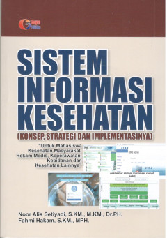
Sistem Informasi Kesehatan (Konsep, Strategi dan Implementasinya)
- Edisi
- Cet.1
- ISBN/ISSN
- 978-602-5411-89-2
- Deskripsi Fisik
- x, 184 hlm.; bibl.; ilus.; 20 cm
- Judul Seri
- -
- No. Panggil
- W 26.55.I4 NOO 2020
- Edisi
- Cet.1
- ISBN/ISSN
- 978-602-5411-89-2
- Deskripsi Fisik
- x, 184 hlm.; bibl.; ilus.; 20 cm
- Judul Seri
- -
- No. Panggil
- W 26.55.I4 NOO 2020

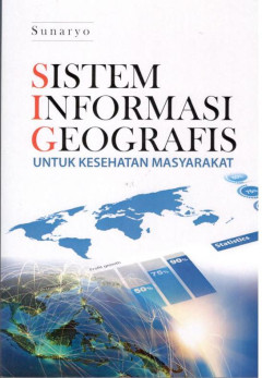
Sistem Informasi Geografis Untuk Kesehatan Masyarakat
- Edisi
- -
- ISBN/ISSN
- 978-602-336-855-6
- Deskripsi Fisik
- xvi, 155 hlm. : ilus.; 21 cm.
- Judul Seri
- -
- No. Panggil
- W 26.55.I4 SUN 2019
- Edisi
- -
- ISBN/ISSN
- 978-602-336-855-6
- Deskripsi Fisik
- xvi, 155 hlm. : ilus.; 21 cm.
- Judul Seri
- -
- No. Panggil
- W 26.55.I4 SUN 2019

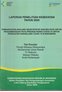
Laporan Penelitian Kesehatan Tahun 2020 : Pemanfaatan Analisis Geostatistik d…
- Edisi
- -
- ISBN/ISSN
- -
- Deskripsi Fisik
- xvii, 50 p. ilus; 30 cm.
- Judul Seri
- -
- No. Panggil
- PGN 2020 3
- Edisi
- -
- ISBN/ISSN
- -
- Deskripsi Fisik
- xvii, 50 p. ilus; 30 cm.
- Judul Seri
- -
- No. Panggil
- PGN 2020 3

Pemanfaatan Citra ASTER dalam Penentuan dan Verifikasi Daerah Rawan Demam Ber…
Distribution of Dengue Hemorrhagic Fever (DHF) can be viewed from geospatial perspective elaborating temperature, rain fall, humidity, and certain land uses information. Remote sensing and GIS approach can be used as effective tool on dengue prevention and control policies. The aim of this study was to identify vulnerable dengue areas in Banjar, West Java through image verification. This st…
- Edisi
- -
- ISBN/ISSN
- 2085-4102
- Deskripsi Fisik
- 8p
- Judul Seri
- -
- No. Panggil
- Aspirator, 6 (2) : 55-62

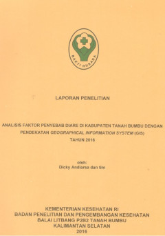
Analisis Faktor Penyebab Diare di Kabupaten Tanah Bumbu dengan Pendekatan Geo…
- Edisi
- -
- ISBN/ISSN
- -
- Deskripsi Fisik
- 99p.; bibl.; ilus.; 29 cm.
- Judul Seri
- -
- No. Panggil
- 429 LIT
- Edisi
- -
- ISBN/ISSN
- -
- Deskripsi Fisik
- 99p.; bibl.; ilus.; 29 cm.
- Judul Seri
- -
- No. Panggil
- 429 LIT

Pemetaan Sistim Informasi Geografis untuk Menggambarkan Kejadian dan Faktor R…
Abstract Hospitalized patients have a high risk of getting nosocomial infections due to various reasons. They tend to be more susceptible to infection because of their underlying disease condition, and they have higher when patients undergo invasive procedures. If the patient's immune system is impaired, the non-pathogenic microorganism are capable of causing disease. Map is a method of illust…
- Edisi
- -
- ISBN/ISSN
- 2085-1545
- Deskripsi Fisik
- 8p
- Judul Seri
- -
- No. Panggil
- SAINS Medika, 5 (2) 2013 : 82-89

Penggunaan Sistem Informasi Geografi Effektif Memprediksi Potensi Demam Berda…
Dengue fever Potential Area at Pademangan Barat Sub District, North Jakarta. Dengue hemorrhagic fever is an infectious disease that contagious by Aedes aegypt mosquito’s bites. Anybody could infectious by this illnes, without differentiate their sex, age, social status, and economic status as well. Nevertheless, at slum area, where mosquito’s larva is easy to find, the number of infectious …
- Edisi
- -
- ISBN/ISSN
- 1693-6728
- Deskripsi Fisik
- -
- Judul Seri
- -
- No. Panggil
- Makara,15(1)2011:21-30

Kandungan Iodium dalam bahan makanan di berbagai letak geografis
- Edisi
- -
- ISBN/ISSN
- -
- Deskripsi Fisik
- 28p
- Judul Seri
- -
- No. Panggil
- 184/243 LIT
- Edisi
- -
- ISBN/ISSN
- -
- Deskripsi Fisik
- 28p
- Judul Seri
- -
- No. Panggil
- 184/243 LIT
 Karya Umum
  Filsafat
  Agama
Agama  Ilmu-ilmu Sosial
  Bahasa
  Ilmu-ilmu Murni
  Ilmu-ilmu Terapan
  Kesenian, Hiburan, dan Olahraga
  Kesusastraan
  Geografi dan Sejarah