Ditapis dengan
# Debug Box
/var/www/perpustakaan972/lib/SearchEngine/DefaultEngine.php:610 "Search Engine Debug 🔎 🪲"
Engine Type ⚙️: "SLiMS\SearchEngine\DefaultEngine"
SQL ⚙️: array:2 [
  "count" => "select count(distinct b.biblio_id) from biblio as b left join mst_publisher as mp on b.publisher_id=mp.publisher_id left join mst_place as mpl on b.publish_place_id=mpl.place_id where b.opac_hide=0 and (b.biblio_id in(select ba.biblio_id from biblio_author as ba left join mst_author as ma on ba.author_id=ma.author_id where ma.author_name like ?))"
  "query" => "select b.biblio_id, b.title, b.image, b.isbn_issn, b.publish_year, mp.publisher_name as `publisher`, mpl.place_name as `publish_place`, b.labels, b.input_date, b.edition, b.collation, b.series_title, b.call_number from biblio as b left join mst_publisher as mp on b.publisher_id=mp.publisher_id left join mst_place as mpl on b.publish_place_id=mpl.place_id where b.opac_hide=0 and (b.biblio_id in(select ba.biblio_id from biblio_author as ba left join mst_author as ma on ba.author_id=ma.author_id where ma.author_name like ?)) order by b.last_update desc limit 10 offset 0"
]
Bind Value ⚒️: array:1 [
  0 => "%Yuneu Yuliasih%"
]

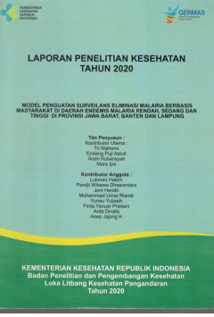
Laporan Penelitian Kesehatan Tahun 2020 : Model Penguatan Surveilans Eliminas…
- Edisi
- -
- ISBN/ISSN
- -
- Deskripsi Fisik
- xviii, 59 p., ilus; 30 cm.
- Judul Seri
- -
- No. Panggil
- PGN 2020 2
- Edisi
- -
- ISBN/ISSN
- -
- Deskripsi Fisik
- xviii, 59 p., ilus; 30 cm.
- Judul Seri
- -
- No. Panggil
- PGN 2020 2

Pemberdayaan Kader Dalam Pengawasan Pemberian Obat Pencegahan Massal (POPM) F…
- Edisi
- -
- ISBN/ISSN
- -
- Deskripsi Fisik
- 93p.; bibl.; ilus.; 30 cm.
- Judul Seri
- -
- No. Panggil
- 466 LIT
- Edisi
- -
- ISBN/ISSN
- -
- Deskripsi Fisik
- 93p.; bibl.; ilus.; 30 cm.
- Judul Seri
- -
- No. Panggil
- 466 LIT

Analisis Risiko Kejadian Demam Berdarah Dengue (DBD) dengan Model Standart De…
- Edisi
- -
- ISBN/ISSN
- -
- Deskripsi Fisik
- 95p.; bibl.; ilus.; 30 cm.
- Judul Seri
- -
- No. Panggil
- 465 LIT
- Edisi
- -
- ISBN/ISSN
- -
- Deskripsi Fisik
- 95p.; bibl.; ilus.; 30 cm.
- Judul Seri
- -
- No. Panggil
- 465 LIT

Pemanfaatan Citra ASTER dalam Penentuan dan Verifikasi Daerah Rawan Demam Ber…
Distribution of Dengue Hemorrhagic Fever (DHF) can be viewed from geospatial perspective elaborating temperature, rain fall, humidity, and certain land uses information. Remote sensing and GIS approach can be used as effective tool on dengue prevention and control policies. The aim of this study was to identify vulnerable dengue areas in Banjar, West Java through image verification. This st…
- Edisi
- -
- ISBN/ISSN
- 2085-4102
- Deskripsi Fisik
- 8p
- Judul Seri
- -
- No. Panggil
- Aspirator, 6 (2) : 55-62

Tingkat Kerawanan Demam Berdarah Dengue Berdasarkan Sistem Informasi Geografi…
ABSTRACT Dengue is an infectious disease that has always been a problem in the town of Banjar and occurs every year, it is highly influenced by environmental risk factors, and the spread of dengue virus, which can be viewed from the perspective of spatial information (geospatial). One of the systems that can be used to determine the risk factors for DHF is by using remote sensing and geographi…
- Edisi
- -
- ISBN/ISSN
- 1412-4025
- Deskripsi Fisik
- 11p
- Judul Seri
- -
- No. Panggil
- Jurnal Ekologi Kesehatan, 12 (2) 2013: 106-116

Konfirmasi Anopheles Barbirostris Sebagai Vektor Malaria Di Walkabubak Melalu…
Anoplieline species confirmed as malaria vector ifthe salivarv gland contained sporozoites. One of the method to confirmed ii was through an Enzvme-Linked Immunosorbent Assay (ELLSA). The aim of this study was to investigate the presence of circum sporozoite protein (CSP) in the mosquito of Anopheles barbirostris with ELJSA method. The study was conducted in malaria endemic area named Modu Waim…
- Edisi
- -
- ISBN/ISSN
- 2085-4102
- Deskripsi Fisik
- 6p
- Judul Seri
- -
- No. Panggil
- ASPIRATOR : Jurnal Penelitian Penyakit Tular Vekto

Status Resistensi Aedes aegypti dengan Metode Susceptibility Di Kota Cimahi t…
Vector control of dengue usually doing by using insecticides, whether by govern¬ment or insecticides used in household. Using to much insecticides for long time can caused resistence of mosquito. This research aim to know resistance status of Aedes aegypti from endemic rural in district Cimahi to cypermethrin (synthetic pyretroid). Resistance status knowing by susceptibility methods (WHO stand…
- Edisi
- -
- ISBN/ISSN
- 2085-4102
- Deskripsi Fisik
- 7p
- Judul Seri
- -
- No. Panggil
- Aspirator, 3 (1) 2011 : 18-24

Penentuan daerah rawan DBD dengan pemetaan berbasis pengideraan jauh dan sist…
- Edisi
- -
- ISBN/ISSN
- -
- Deskripsi Fisik
- 36 p.
- Judul Seri
- -
- No. Panggil
- 217 LIT
- Edisi
- -
- ISBN/ISSN
- -
- Deskripsi Fisik
- 36 p.
- Judul Seri
- -
- No. Panggil
- 217 LIT

Perilaku Masyarakat Dan Indeks Entomologi Vektor Demam Berdarah Dengue Di Kot…
Dengue haemorhagic fever (DHF) was one of most dangerous disease in Indonesia. The number of case showed increased year by year since first time observed. Vector control that used by government always using Insecticides. A continuity of it can caused resistances of mosquito, and it will be more dangerous. In District Cimahi, vector control doing by mosquitoes habitat eradication (PSN) fo…
- Edisi
- -
- ISBN/ISSN
- 2085-4102
- Deskripsi Fisik
- 8p
- Judul Seri
- -
- No. Panggil
- Aspirator (Jurnal Penelitian Penyakit Tular Vektor
 Karya Umum
  Filsafat
  Agama
Agama  Ilmu-ilmu Sosial
  Bahasa
  Ilmu-ilmu Murni
  Ilmu-ilmu Terapan
  Kesenian, Hiburan, dan Olahraga
  Kesusastraan
  Geografi dan Sejarah